Bid to recognise historic summit landmarks

 C20 Society
The camera roll of an outdoor lover is guaranteed to contain several images of them standing next to a trig point marking the summit of fells, moorlands and crags. Now a charity wants the architectural features recognised for their importance.
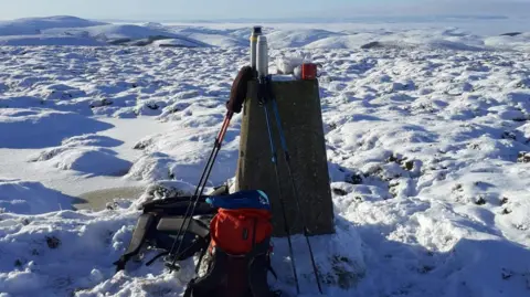
There are about 5,500 trigonometrical stations, also known as trig pillars, still standing across Britain's landscape and some enthusiasts have become known as "trig-baggers", walking their way across the landscape to tick them off.
The pillars are the remnants of efforts to remap the country between 1936 and 1962, using a more accurate method than the measurements taken in the previous centuries.
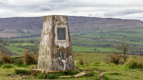
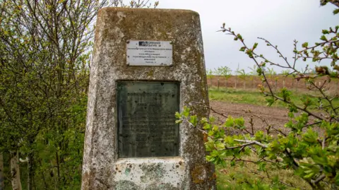
Charity Twentieth Century Society (C20 Society), which campaigns to protect modern architecture, has submitted applications to Historic England to list the first and last to be observed as part of the project - the pillar at Cold Ashby in Northamptonshire and at Thorny Gale, near Appleby-in-Westmoreland in Cumbria.
"They're a quirky feature of the British countryside and I think that's why people love them," said Mark Greaves from The Ordnance Survey (OS), which owns the pillars.
"Especially if you're walking, hiking, climbing a fell, it's almost a comforting sight - there's the pillar, I've reached the top of the hill," he said.
"Trig-baggers" aim for them as they reach not only the heights of Scafell Pike in the Lake District, England's highest peak at 3,209 ft (978 metres), but also smaller points like Beaumont Hill Trig Point in Darlington, at just 305ft (93 metres), or the East Grange Trig Point at 338ft (103 metres) which sits in a hedge on the outskirts of Durham.
Of course, they top many of the major hills across our national parks such as the Peak District, Snowdonia, the South Downs and the Cairngorms.
 Ordnance Survey
Greaves said: "Now of course, enabled by the internet and social media, people visit trig-pillars for their own sake, people collect them, tick them off and can share their visits and photographs on various websites."
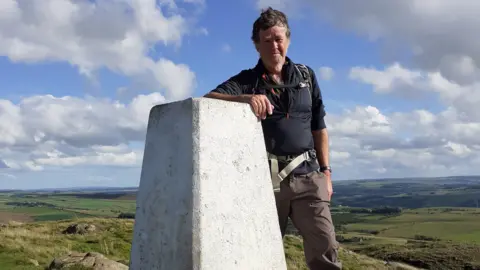
Patrick Norris, a walking guide in Northumberland where there are 168 trig points, said while some people make reaching a trig point the purpose of a walk, they are still useful for navigation.
"You need to know where you are, in order to work out how to go in the direction you want to and trig points are those useful fixed locations," he said.
 Patrick Norris
He said while many are hidden away, others are very well-known.
"The one that stands out is at Winshield Crags, it marks the highest point on Hadrian's Wall path national trail and thousands of people pass it every year," he said.
But there is also a very well-known one at the top of Cheviot, the highest point in Northumberland, he added.
C20 Society said the remapping that happened between 1936 and 1962, marking the birth of the trig-pillar, was also the foundation of the Ordnance Survey National Grid.
 Patrick Norris
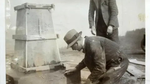
The trig pillar was designed in 1935 by Brigadier Martin Hotine as a 4ft (1.2 metre) truncated square-based pyramid tapered towards the top.
"The flat top surface provided a solid base for theodolites to be positioned on a three-grooved brass plate called a 'spider'," a C20 Society spokesman explained.
"These were the precision instruments used by survey teams to improve the accuracy of the readings they obtained."
Using these tools they triangulated - or separated - the country into a network of triangles, improving mapping accuracy.
Of the 6,500 pillars initially built, about 1,000 have been lost, according to Greaves.
The OS decided it no longer needed the majority of pillars in the 1990s and if one is damaged or considered dangerous the "appropriate action" is taken, which may mean repairing or removing it.
"Other than that there's no actual active maintenance that takes place," Greaves said.
 McCoy Wynne Photography
C20 Society hopes its bid to register the first and last trig pillars will help preserve them and their historic significance.
"Long before GPS, satellite technology, and navigational apps on our mobile phones, trig points were the humble concrete pillars that mapped a nation," charity director Catherine Croft said.
She added: "Nothing beats the modest triumph of standing on top of a Trig Point in a brisk wind and we hope these two modern obelisks of concrete in the countryside will soon be recognised."
