What does new research tell us about blue carbon?

 CRAIG GOFFIN
New research into how much carbon is absorbed by the Isle of Man's marine habitats has been published.
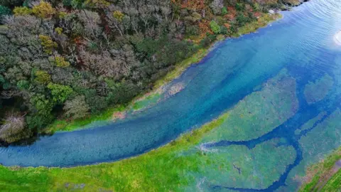
The Manx Blue Carbon Research Project set out to understand the size of the island's blue carbon habitat, assess the potential for carbon storage, identify any threats and look at monitoring and restoration options.
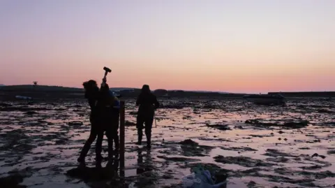
The research, led by the Department for Environment, Food and Agriculture (Defa) saw scientists map habitats across Manx waters between 2022 and 2025.
Project lead Rowan Henthorn said: "By building a clear evidence base for how our marine ecosystems store carbon, we now have the tools to make informed, long‑term decisions."
What did the research find?
 ROWAN HENTHORN
The project saw the mapping of habitats, including 50,000 hectares (123,552 acres) of offshore muddy seabed, 196 hectares (484 acres) of seagrass and 7.4 hectares (18.3 acres) of coastal wetlands or seamarsh.
Researchers discovered the top 10cm of these habitats stored 500,000 tonnes of carbon - equivalent to 1.8m tonnes of carbon dioxide or the annual emissions of about 390,000 cars.
The Western Irish Mud Sea Belt, located off the island's west coast, was found to store the most - about 510,312 tonnes of carbon.
Initial research has found that carbon storage is lower in areas with higher fishing intensity, something that is being further investigated by Bangor University.
The research also found that saltmarshes stored about 170 tonnes while seagrass meadows captured about 169 tonnes of carbon.
While saltmarsh had the highest carbon density, less coverage limited its carbon storage capacity on the island.
Efforts to expand saltmarsh are limited by existing roads and development and efforts should therefore focus on protection and effective management of the habitat, the report recommended.
What does the report recommend?
The report made eight recommendations.
They aim to seek political approval for and an action plan to be developed for their implementation.
They include ongoing monitoring of the blue carbon habitats and continued investigation on the impacts of climate change on them.
It also suggested guidance should be created for planning applications and policies impacting blue carbon habitats, with training to be provided to ensure informed decisions were made.
In 2024, a ban on bottom trawling was introduced in three parts of the Western Irish Sea Mud Belt until the end of 2026 while research by Bangor University into blue carbon and seabed habitats was being carried out.
The report said once that concludes, fishing activities in the area should be reviewed to enhance carbon storage.
What are the next steps?
 DAVID BEARD
In a four-year action plan from 2026 to 2030, the Manx government said it would progress plans to create a marine nature reserve off Bulgham Bay in Maughould and complete final boundary revisions.
Plans for eelgrass conservation zones will also be progressed, with reviews of the areas to be reviewed every six years.
Unprotected saltmarsh would be protected under areas of special scientific interest, subject to landowner agreement.
Codes of practice on activities that impact blue carbon habitats, such as anchoring, bait, digging, and trampling will also be updated.
And management measures for the Western Irish Sea Mud Belt will be implemented based on research outcomes and closure trials.
Environment, Food and Agriculture Minister Clare Barber said: "The Manx Blue Carbon Project has shown just how important our seas are, not only for wildlife and fisheries, but also for tackling climate change.
"This research, including the report and supporting papers, gives us the evidence we need to protect our marine environment wisely, support sustainable economic opportunities, and ensure these benefits endure," she added.
Read more stories from the Isle of Man on the BBC, watch BBC North West Tonight on BBC iPlayer and follow BBC Isle of Man on Facebook and X.
