'Pork Pie Way' among choice of names for new bypass

 Leicestershire County Council
A public vote is being held to choose the name of Melton Mowbray's new bypass.
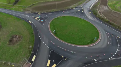
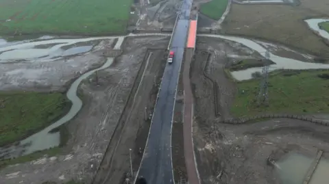
Leicestershire County Council has shortlisted nine options as potential names for the 4.4-mile (7.1km) route around the north and east of the town, which is due to open in May.
The shortlist has been drawn up after discussions with local politicians, community representatives and council officers.
People have until 5 May to vote online, and the council said the most popular choice would become the formal name for the road, which is currently officially known as the North and East Melton Mowbray Distributor Road (NEMMDR).
The council said the new road was the largest highways scheme it has ever undertaken.
Officials said the road would provide an alternative route for traffic, particularly HGVs, and would cut congestion and pollution in the town centre.
 Getty Images/Bloomberg
Adam Tilbury, the council's cabinet member for highways and transport, said: "We want residents to be part of this milestone.
"Melton Mowbray's new distributor road marks a significant moment for the town, thanks to the council's biggest ever transport investment, and we want the community to share in that achievement.
"We've brought together a shortlist of names that celebrate Melton's heritage and landscape.
"Now we're inviting people to get involved, learn more about the project and tell us which name they feel best represents this new chapter."
Acting leader of Melton Borough Council, Margaret Glancy, said: "We are keen for our residents to have their say on this important investment into the local area, and we encourage everyone to take part in the survey and help to choose a name that reflects Melton's character and heritage."
List of choices
- Pork Pie Way – reflecting Melton Mowbray's long-standing national reputation as the home of the famous Melton Mowbray pork pie
- River Eye Road comes from the River Eye, which runs through Melton Mowbray
- Wreake Road – taken from the River Wreake, which flows close to Melton Mowbray
- Lazars Way – refers to nearby Burton Lazars, which takes its name from the medieval Knights of St Lazarus, who had a significant historical presence in the area
- Wolds Way – refers to the nearby Wolds landscape, reflecting the town's rural setting and connections to the countryside
- Farrier Way – Farriers trained at the Melton Mowbray Defence Animal Training Regiment
- Victory Road – recognises Melton Mowbray's historic links to national moments of victory and remembrance
- Military Way – reflects Melton Mowbray's strong and long-established links with the armed forces
- Veteran Road – recognises the contribution of veterans and highlights Melton Mowbray's continuing military connections
 Leicestershire County Council
The final cost of the scheme is expected to be about £134m - nearly twice the original budget of £63.5m.
It will also include more cycling and walking routes.
It has been jointly funded by the council, the government, and developers who plan to build 4,500 homes in the area in the long term.
The council said long-term plans still remained for an extra section of the road to continue around the south of the town, although it said there was no defined timescale for that phase of the project.
As it stands, that southern extension to the road would be funded by contributions from housing developers and would be built when new homes are delivered.
Follow BBC Leicester on Facebook, on X, or on Instagram. Send your story ideas to eastmidsnews@bbc.co.uk or via WhatsApp on 0808 100 2210.
