A film explaining the causes and consequences of river flooding, with case studies from the UK and around the world.
Video
River flooding occurs when the river water rises so high it breaches the riverbank and overflows onto the land around it.
It usually happens a couple of days after heavy rainfall. You might ask why flooding happens after and not during heavy rainfall. It's because it takes time for rainwater to flow downstream, via many small streams from higher ground, to join the main river below. Flooding occurs when the collective volume of water becomes too much for the river to hold.
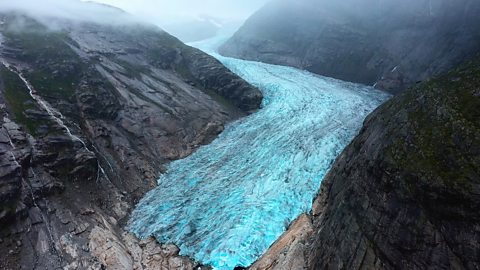
The same thing happens when the snow melts on the tops of hills and mountains. The meltwater flows downhill, adding to the volume of water in the river system, which can lead to flooding downstream in the days that follow.
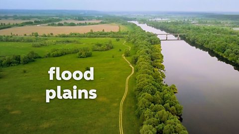
Flood plains are areas of land around rivers where water can overspill at times of flooding.
If flood plains are left undeveloped, water can spill onto them to protect houses and buildings further downstream. Eventually, the water seeps back into the river or into the ground.
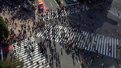
If there isn't a flood plain, or when a flood plain has been built on, problems can arise. This is a particular problem for towns and cities that have rivers running through them.
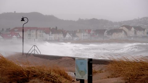
Flood water can't seep through concrete or tarmac, so gets higher and higher, often flooding people's homes and businesses.
Rivers forge a natural course through the landscape. Sometimes, humans intervene to alter this natural path, but this can often increase the risk of flooding.
The Mississippi River in the southern United States is a good example of this. It is one of the most engineered rivers in the world, and researchers believe that up to three quarters of severe flooding incidents on the Mississippi in the last one hundred years have been a direct result of human engineering, including attempts to straighten the river for easier shipping and transport. Sometimes man-made defences, such as levees - banks built to stop water from flooding out of the river - even trap floodwater and prevent it from returning to the river.
Where rivers are straight, water flows more quickly so there is little risk of flooding upstream. However, the faster flow downstream means the river is more powerful there and erosion stronger, making the risk of flooding greater.
River floods can be destructive to homes and businesses and even a threat to human life.
Video summary
Download/print a transcript of the video.
A short film for secondary schools explaining the causes and consequences of river flooding, with case studies from the UK and around the world.
It explores the impact of river flooding on communities and how patterns of flooding are changing over time.
It helps meet the requirements of National Curriculum physical geography at KS3 with regard to:
- geological timescales and plate tectonics
- rocks, weathering and soils
- weather and climate, including the change in climate from the Ice Age to the present
- and glaciation, hydrology and coasts.
Teacher notes
Download/print the Teacher Notes for this episode (pdf).
Before watching the video
Ask students what flooding is, and why it can happen along rivers. Discuss with students what they think the impacts of flooding are.
Introduce key terms such as:
Meltwater: Water released by the melting of snow or ice.
Floodplain: A flat, low-lying area of land adjacent to a river or stream that is prone to flooding.
Levees: An artificial embankment alongside a river which are used to.
During the video
You may wish to stop at relevant points during this short film to pose questions and check understanding or wait until the end.
Useful questions might include:
- Why does flooding occur?
- What is meltwater?
- What are floodplains?
- Why are floodplains important?
- Why shouldn’t we build on a floodplain?
- What has happened to the Mississippi river?
- What issues can flooding cause?
After watching
Ask students to pick out five key pieces of information from the clip about river flooding. If there has been river flooding near your location this could be discussed with students – what do they remember about it and what were the impacts?
Task students with researching the Somerset Levels flood that occurred in 2014. What were the impacts of flooding, categorise these into social, economic and environmental. How long did it take for conditions to return to ‘normal’ after the flooding?
Where next?
Ask students how they could prepare for flooding. Task students with creating a guide to how to prepare for flooding.
The Flood Hub is a good place to start researching.
Students and teachers over the age of 16 can create a free Financial Times account. For a Financial Times article about extreme flooding in the UK from 2020, click here.
Curriculum notes
This short film is relevant for teaching geography at KS3 in England, Wales and Northern Ireland and 3rd and 4th Level in Scotland.
This short film helps meet the requirement of the Key Stage 3 national curriculum in geography requirement to develop and understanding of:
- physical geography relating to: geological timescales and plate tectonics; rocks, weathering and soils; weather and climate, including the change in climate from the Ice Age to the present; and glaciation, hydrology and coasts.
More videos from this series
Primary and secondary industries. video
A short film for secondary schools explaining primary and secondary industries.
Tertiary and quaternary industries. video
A short film for secondary schools explaining tertiary and quaternary industries, what they are and how they fit into global economy.

Erosion. video
A short film for secondary schools explaining the various types of erosion and illustrating the dramatic effect the process has had on landscapes across the world.
Plate tectonics. video
A short animated film for secondary schools detailing tectonic plates, their movement and boundaries, and what this means for Earth.
Responses to flooding. video
A short film for secondary schools explaining the common responses to flooding and the methods employed to prevent and reduce flooding. Footage shows examples of hard and soft engineering techniques.
Glaciation. video
A short film for secondary schools explaining glaciation: what it is, how it shapes the land and the effects of climate change on the world’s glaciers.
Rapid urbanisation. video
Investigates how rapid urbanisation impacts on both urban and rural areas and the challenges this presents.
Coastal flooding. video
Illustrated with case studies, this short film for secondary schools explains the causes and results of coastal flooding, focussing primarily on instances in the UK.
Climate. video
A short animated film for secondary schools describing the factors that determine the climate of a country and the main climate zones of the world.